Fjörður Coastal Trek
Fjörður
A remote 43 km, 2–3 day trek through the abandoned fjords and coast of Fjörður and Látraströnd north of Grenivík.
- Distance
- 43 km
- Point to point
- Time
- 2–3 days
- Ascent
- 2200 m
- Max 520 m
- Difficulty
- Expert
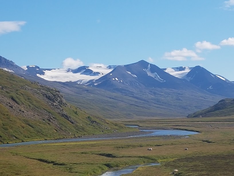
The Fjörður trek is a remote multi-day hike through the uninhabited fjords and coast of the peninsula between Eyjafjörður and Skjálfandi in North Iceland. The point-to-point route runs from the end of the F839 track in Hvalvatnsfjörður to Svínárnes on Látraströnd, about 43 km with roughly 2,200 m of total ascent and a high point near 520 m, and takes 2–3 days. It passes through abandoned farmland, steep mountain passes and wild coastline, with no roads and few other hikers.
Fjörður, meaning 'fjords', refers to the valleys around Hvalvatnsfjörður and Þorgeirsfjörður, which were farmed for centuries before being abandoned in the mid-20th century. Látraströnd is the steep coast along outer Eyjafjörður. The trek is rated expert, with steep climbs, river crossings and remote terrain far from help. It suits experienced hikers who are comfortable navigating in fog and carrying everything they need, or anyone joining a guided group.
Highlights
- Abandoned farms and the remains of old settlements
- Steep mountain passes with wide views
- Wild, uninhabited coastline
- Solitude far from roads and crowds
Fjörður Coastal Trek itinerary
Day 1: Into Fjörður
The trek starts at the end of the F839 in Hvalvatnsfjörður, crossing grassy lowland and abandoned farmland where old turf walls and ruins are still visible. The route follows old paths and tracks with some streams to cross, which can be deeper after rain. Camp or stay in a simple hut depending on availability, and enjoy the silence of a valley with no road traffic.
Day 2: Over the mountains
The second day climbs over steep passes between the fjords and the coast, with the high point of the route around 520 m. The ground is rough and loose in places, and snow may linger early in the season. Views over the sea and mountains are spectacular.
Day 3: Along Látraströnd
The final section follows the coast of Látraströnd, passing abandoned farm sites, steep slopes and stony beaches with views across to Hrísey. The route ends at Svínárnes, at the road end on Látraströnd north of Grenivík, so arrange a pickup in advance.
Getting to the trailhead
Access to Fjörður is by the F839 mountain track over Leirdalsheiði from Route 83 near Grenivík, which requires a 4x4 and is usually open only in midsummer. Many hikers arrange a drop-off or a guided trip. The route ends at Svínárnes on Látraströnd, where the road from Grenivík ends, so arrange a pickup there. Check road.is before driving.
Where to stay
There are simple huts at Gil, Þönglabakki, Keflavík and Látur, owned by Ferðafélagið Fjörðungur in Grenivík; check with them for current options and bookings. Camping is possible, but bring everything you need. Grenivík and Akureyri have accommodation before and after the trek.
Best time to hike
Snow can linger on the passes into early summer, and the access track is usually open only from midsummer. July and August are the most reliable months. September brings autumn colours but shorter days and more unsettled weather.
Safety
This is a remote area with no roads, limited mobile coverage and few other hikers. Rivers can be dangerous after rain or snowmelt, so cross carefully and turn back if in doubt. Weather can change quickly, with fog and snow possible at any time. Carry a map, GPS, warm layers, food and a tent. Leave a travel plan on SafeTravel.is, check vedur.is and call 112 in an emergency.
Plan & book
Book your Fjörður Coastal Trek hike
 Camping
Ásbyrgi & Vesturdalur Campsites
National park campsites in Jökulsárgljúfur canyon.
Vatnajökull National Park
Guided tourDiamond Circle & Canyon Tours
Dettifoss, Ásbyrgi and Mývatn from Akureyri or Húsavík.
North Iceland operators1 day
Trek packageMulti-Day Trekking Packages
Guided or self-guided packages: huts, luggage transfers, meals and transport, all arranged for you.
Licensed Icelandic operators3–10 days
Online booking opens soon. Press any button to get notified when it does.
Fjörður Coastal Trek FAQ
How long is the Fjörður trek?+
The route is about 43 km with roughly 2,200 m of total ascent, usually taking 2–3 days.
Is the Fjörður trek hard?+
Yes, it is rated expert because of the length, steep climbs, river crossings and remote terrain.
How do you get to Fjörður?+
Access is by the F839 mountain track, which requires a 4x4 and is usually open only in midsummer. Many hikers arrange a drop-off or join a guided trip.
Are there huts on the Fjörður trek?+
Yes, there are simple huts at Gil, Þönglabakki, Keflavík and Látur, owned by Ferðafélagið Fjörðungur in Grenivík. Check with them for current options and bookings.
Hike it with a private guide
Guided trips with a licensed Icelandic guide, including transport and huts.
Private guide requests are coming soon
We are lining up licensed local guides. Sign up and we will let you know as soon as you can request a tailored quote.