Hallormsstaður Forest Cliffs
Bjargselsbotnar
A short 4 km loop through Hallormsstaður, one of Iceland's largest forests, to the small cliffs and hollows of Bjargselsbotnar.
- Distance
- 4 km
- Loop
- Time
- 1–1.5 hours
- Ascent
- 170 m
- Max 280 m
- Difficulty
- Easy
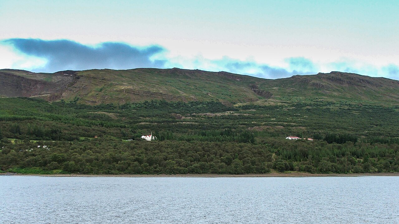
The Hallormsstaður forest hike is a short loop through one of Iceland's largest forests and its first national forest (protected 1905), on the eastern shore of Lake Lagarfljót in East Iceland. It covers 4 km in 1–1.5 hours, with 170 m of ascent and a high point of 280 m. It is an easy, shaded walk, very different from the open landscapes of most Icelandic hikes. It suits families and anyone wanting a gentle walk.
The trail climbs through native birch and planted conifers to Bjargselsbotnar, a series of small cliffs and hollows on the hillside, then loops back down through the trees. Along the way, gaps in the forest give views over Lagarfljót and the valley. It is a peaceful walk, good in changeable weather when exposed hikes are less appealing. Birdsong is a rare treat in Iceland.
Highlights
- Walking through Iceland's first national forest, protected in 1905
- Native birch alongside planted larch, spruce and pine
- Small cliffs and hollows at Bjargselsbotnar
- Views over Lake Lagarfljót through the trees
The route
Into the forest
The trail starts at the sign by Hallormsstaðaskóli, follows light-green markers and climbs through a mix of birch and conifers. The path is clear and shaded, with some steeper sections. Signs mark the junctions with other forest paths. The trees give welcome shelter on windy days, and the forest floor is carpeted with moss and berries in late summer.
Bjargselsbotnar and the return
Higher up, the trail reaches Bjargselsbotnar, with small cliffs and hollows in the hillside and views over the lake. The loop then descends back through the forest to the start. The descent can be muddy after rain. The forest has many other paths if you want to walk further.
Getting to the trailhead
Hallormsstaður lies on Route 931 along the eastern shore of Lagarfljót, about 25 km south of Egilsstaðir, roughly a 30-minute drive. Parking is available near the forest paths. Public transport is limited, so a car is the practical option. Roads are paved.
Where to stay
Hallormsstaður has a hotel and the Atlavík campsite on the lakeshore. Egilsstaðir, about 30 minutes away, has a wider range of hotels, guesthouses and services. Book ahead in July and August, when the area is popular with Icelandic holidaymakers.
Best time to hike
May to October is the best time. Summer brings long days and green woods, while September and October offer autumn colours. Early and late in the season the path can be muddy or icy.
Safety
This is a low-risk walk, but paths can be muddy and slippery, and some sections are steep. Keep back from the edges of the small cliffs at Bjargselsbotnar. Weather can change quickly. Check the forecast and SafeTravel.is, and call 112 in an emergency.
Plan & book
Book your Hallormsstaður Forest Cliffs hike
 Camping
East Iceland Campsites
Campsites around Egilsstaðir and Hallormsstaður forest.
Tjalda.is directory
Guided tourEast Iceland Tours from Egilsstaðir
Stuðlagil, Hengifoss and the eastern fjords with a local guide.
Local operators1 day
Online booking opens soon. Press any button to get notified when it does.
Hallormsstaður Forest Cliffs FAQ
How long is the Hallormsstaður forest hike?+
The loop is 4 km and takes 1–1.5 hours, with 170 m of ascent.
Is the Hallormsstaður forest hike easy?+
Yes. It is short and on clear forest paths, though some sections are steep and can be muddy.
Is Hallormsstaður the largest forest in Iceland?+
It is one of the largest, and it was Iceland's first national forest, protected in 1905. It has native birch and many planted tree species.
Hike it with a private guide
Guided trips with a licensed Icelandic guide, including transport and huts.
Private guide requests are coming soon
We are lining up licensed local guides. Sign up and we will let you know as soon as you can request a tailored quote.