Vindbelgjarfjall
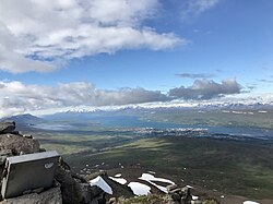
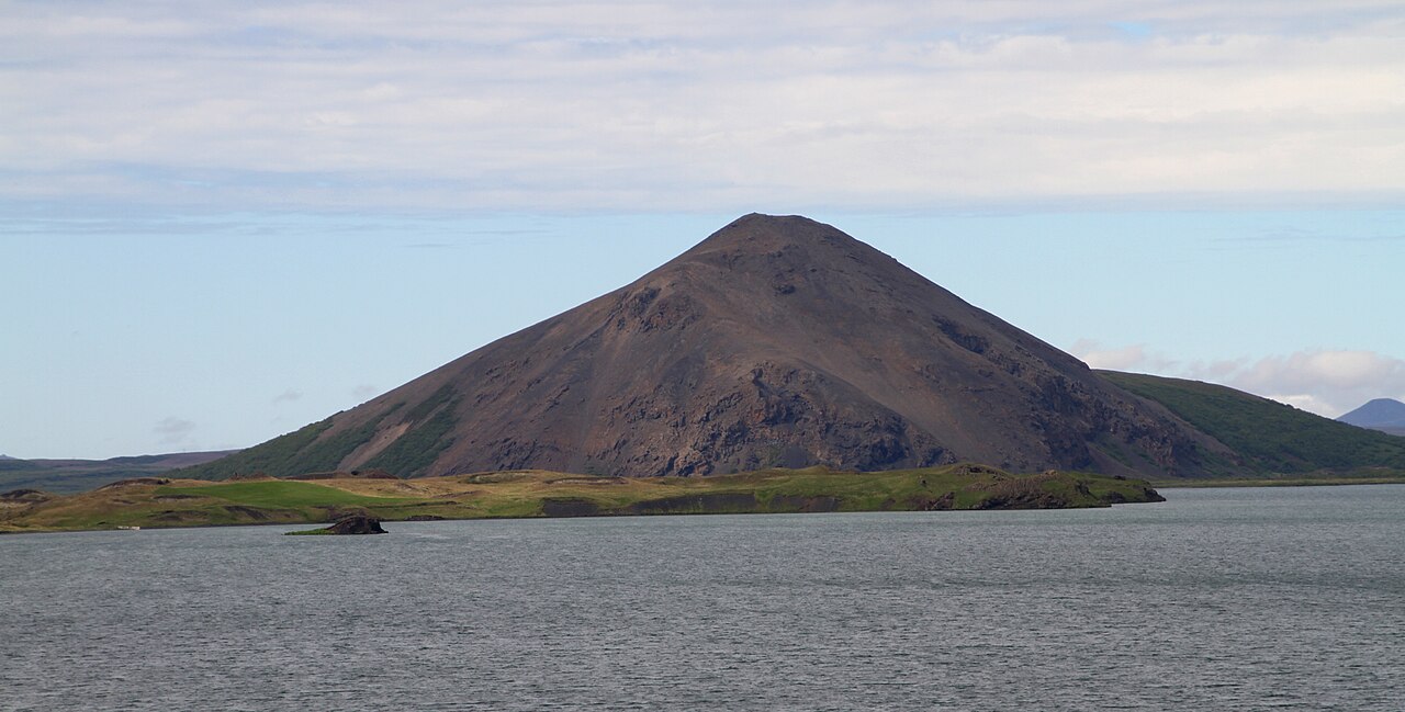
A short, steep climb up Vindbelgjarfjall for one of the best views over Lake Mývatn and its islands.
- Distance
- 5 km
- Out & back
- Time
- 1.5–2 hours
- Ascent
- 260 m
- Max 529 m
- Difficulty
- Easy
The Vindbelgjarfjall hike is a short mountain walk on the west side of Lake Mývatn in North Iceland, and it offers one of the best views over the lake, its scattered islands and pseudocraters. The out-and-back route is about 5 km round trip with roughly 260 m of ascent, reaching a high point near 530 m, and takes 1.5–2 hours. It is rated easy, though the final climb to the top is steep and rocky.
The path starts on flat ground near the lake and crosses grassland before heading up the mountain. Vindbelgjarfjall stands alone, so the view from the top is wide: on a clear day you see the whole lake, the Laxá river flowing out, and mountains such as Hverfjall and Bláfjall in the distance. It is much quieter than the main sights around Mývatn and a good choice for an evening walk.
Highlights
- Panoramic views over Lake Mývatn and its islands
- Close look at the pseudocraters and wetlands around the lake
- A quiet alternative to the busy Mývatn sights
- Short enough for an evening walk
The route
Lakeshore to the foot of the mountain
From the Vindbelgur parking area by Vagnbrekka farm on Route 1, on the north-west shore of Mývatn, the path crosses flat grassland and heath toward the mountain. The lowland around the lake is important for nesting birds, so keep to the path. The going is easy, with a few wet patches.
Climb to the top
The path then climbs steeply up the mountainside on loose rock and gravel, with a few zigzags. It is short but steep enough to need care, especially coming down. At the top, the view opens across the whole lake. Return the same way.
Getting to the trailhead
Vindbelgjarfjall is on the north-west side of Lake Mývatn, about 10 km west of Reykjahlíð on Route 1. The trailhead parking, signed Vindbelgur, is by the farm Vagnbrekka, close to the lakeshore. Route 1 around the lake is paved, but there is no practical public transport to the trailhead, so you will need a car or bike.
Where to stay
Reykjahlíð on the north-east shore has the most accommodation, with hotels, guesthouses, a campsite and a supermarket. There are also places to stay near Skútustaðir and around the lake shore.
Best time to hike
May to October is the season. June and July give the longest light and the best birdlife on the lake, but also the most midges on calm days. September brings autumn colours and fewer insects. In winter the path is snow-covered and the steep top section can be icy.
Safety
The main risk is the steep, loose final climb, especially on the way down. Wear boots with good grip. The top is exposed to wind, so bring a warm layer. In bird nesting season, stay on the path to avoid disturbing birds. Check SafeTravel.is and vedur.is, and call 112 in an emergency.
Plan & book
Book your Vindbelgjarfjall hike
 Camping
Ásbyrgi & Vesturdalur Campsites
National park campsites in Jökulsárgljúfur canyon.
Vatnajökull National Park
Guided tourDiamond Circle & Canyon Tours
Dettifoss, Ásbyrgi and Mývatn from Akureyri or Húsavík.
North Iceland operators1 day
Online booking opens soon. Press any button to get notified when it does.
Vindbelgjarfjall FAQ
How long is the Vindbelgjarfjall hike?+
It is about 5 km round trip with roughly 260 m of ascent, taking 1.5–2 hours.
Is the Vindbelgjarfjall hike hard?+
It is rated easy overall, but the final climb is steep and loose. Take care on the descent.
Where is the best view over Lake Mývatn?+
Vindbelgjarfjall is one of the best viewpoints over the lake. Hverfjall crater on the east side also gives excellent views.
Hike it with a private guide
Guided trips with a licensed Icelandic guide, including transport and huts.
Private guide requests are coming soon
We are lining up licensed local guides. Sign up and we will let you know as soon as you can request a tailored quote.