Kaldalón
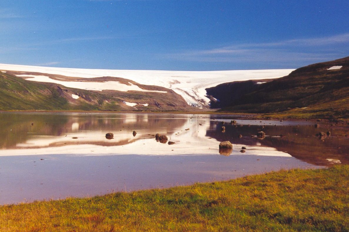
A flat 10 km valley walk from Kaldalón lagoon toward the retreating snout of Drangajökull in the Westfjords.
- Distance
- 10 km
- Out & back
- Time
- 2.5–3.5 hours
- Ascent
- 100 m
- Max 90 m
- Difficulty
- Moderate
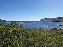
The Kaldalón hike is a quiet, mostly flat valley walk in the Westfjords of Iceland that leads from a sheltered lagoon on Ísafjarðardjúp toward an outlet glacier of Drangajökull, the only ice cap in the Westfjords. The out-and-back route is about 10 km round trip with roughly 100 m of total ascent and a high point near 90 m, and takes 2.5–3.5 hours. You walk up a wide glacial valley of gravel flats, meltwater streams and ice-smoothed rock, with the glacier front growing ahead.
Kaldalón means 'cold lagoon', and the composer Sigvaldi Kaldalóns, who worked as a doctor nearby, took his name from it. It is a remote spot with few visitors, and the walk is more about atmosphere than drama: big skies, the sound of meltwater and the slow sense of how far the ice has retreated. It is rated moderate because of loose gravel, boggy patches and stream crossings rather than climbing. Do not go onto the glacier itself without a guide and equipment.
Highlights
- Close views of a Drangajökull outlet glacier
- Wide glacial valley with braided meltwater streams
- Ice-polished rock showing how far the glacier has retreated
- Remote, quiet setting on the shores of Ísafjarðardjúp
The route
From the lagoon up the valley
From the parking area near the head of the lagoon, the route follows the valley floor inland. The path is faint in places and crosses gravel flats and grassy patches, with marker cairns or a trodden line to follow. Expect small streams to cross; most can be stepped over, but some may need wading after rain or on warm afternoons.
Toward the glacier and back
Further up, the vegetation thins and you walk over rock and moraine toward the glacier front. Stop at a safe distance from the ice: glacier snouts shed blocks without warning and meltwater channels can be fast and deep. Return the same way, with views out over Ísafjarðardjúp ahead of you.
Getting to the trailhead
Kaldalón is on the Snæfjallaströnd side of Ísafjarðardjúp. From Route 61, take Route 635 north along the shore toward Kaldalón; it is a gravel road, so drive carefully and check road.is. There is space to park near the head of the lagoon. From Ísafjörður the drive is long, around two to three hours, as the road follows the winding fjords of Ísafjarðardjúp.
Where to stay
Accommodation along Ísafjarðardjúp is sparse: a few farm guesthouses and campsites operate in summer, so book ahead. Ísafjörður and Hólmavík have more choice, along with shops and fuel. Many visitors combine Kaldalón with a drive around the fjords rather than staying close by.
Best time to hike
June to September is the hiking season. July and August bring the warmest weather and longest days, but also the highest meltwater flow in the afternoon. Early June can still have snow lying in the valley. September is quiet and atmospheric, but check the forecast carefully.
Safety
Meltwater streams can rise quickly on warm or rainy days, so cross early, unbuckle your pack and turn back if a crossing looks deep or fast. Keep well away from the glacier front, which can calve or collapse, and never walk on the ice without a guide. The area is remote with limited mobile coverage. Leave a travel plan on SafeTravel.is, check vedur.is and call 112 in an emergency.
Plan & book
Book your Kaldalón hike
 Trek package
Multi-Day Trekking Packages
Guided or self-guided packages: huts, luggage transfers, meals and transport, all arranged for you.
Licensed Icelandic operators3–10 days
Gear rentalHiking & Camping Gear Rental in Reykjavík
Rent tents, sleeping bags, stoves, poles and microspikes instead of flying them over.
Reykjavík outfitters
Online booking opens soon. Press any button to get notified when it does.
Kaldalón FAQ
How long is the Kaldalón hike?+
The out-and-back route is about 10 km round trip with roughly 100 m of total ascent. Most people take 2.5–3.5 hours.
Can you walk on the glacier at Kaldalón?+
Not safely without a guide, crampons and glacier training. The walk is to view the glacier front from a safe distance, not to go onto the ice.
Is Kaldalón hard?+
It is rated moderate. There is little climbing, but the ground is loose and boggy in places and you may need to cross meltwater streams.
Hike it with a private guide
Guided trips with a licensed Icelandic guide, including transport and huts.
Private guide requests are coming soon
We are lining up licensed local guides. Sign up and we will let you know as soon as you can request a tailored quote.