Látrabjarg Bird Cliffs
Látrabjarg
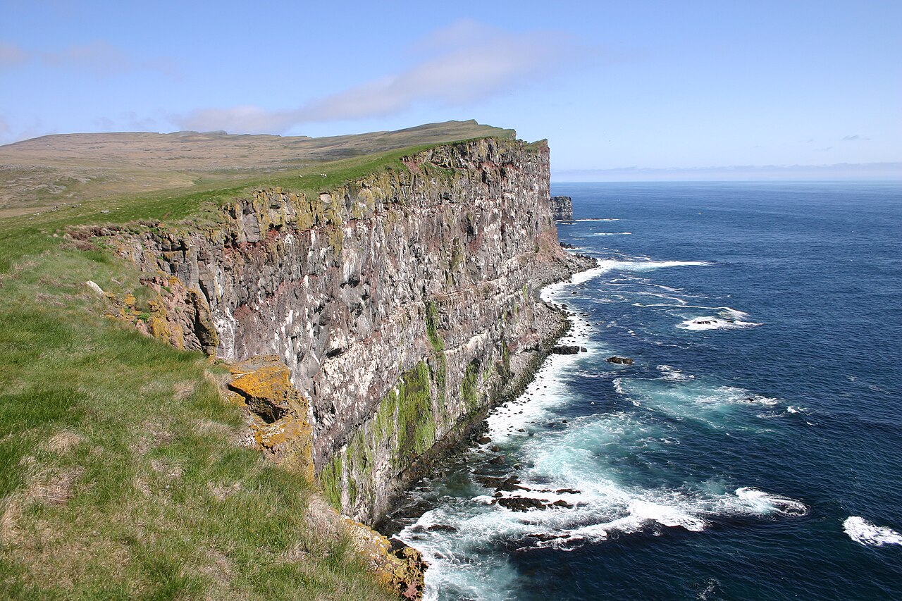
Walk the rim of Látrabjarg, Europe's westernmost cliffs, from Bjargtangar lighthouse along a huge seabird colony.
- Distance
- 15 km
- Out & back
- Time
- 4.5–6 hours
- Ascent
- 650 m
- Max 440 m
- Difficulty
- Challenging
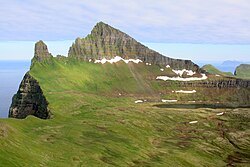
The Látrabjarg cliff walk follows the top of the westernmost point of Iceland, a wall of sea cliffs that stretches for kilometres and drops straight into the Atlantic. This out-and-back route from Bjargtangar lighthouse runs east along the cliff edge and back, about 15 km round trip with roughly 650 m of total ascent and a high point near 440 m. Allow 4.5–6 hours. In summer the cliffs host one of the largest seabird colonies in the North Atlantic, with puffins, razorbills, guillemots and fulmars nesting on the ledges.
Most visitors walk only a few hundred metres from the car park to see the puffins, which is worth doing on its own. Continuing along the rim is a different experience: the cliffs grow taller, the crowds vanish and the path rolls up and down over grassy headlands, which is where that ascent figure comes from. It is rated challenging for its length and constant climbs. You can turn around at any point, so it works for any fitness level as long as you respect the cliff edge.
Highlights
- Puffins at close range near Bjargtangar, roughly May to August
- Sheer cliffs rising to well over 400 m above the sea
- Bjargtangar lighthouse at Europe's westernmost point
- Huge colonies of guillemots, razorbills and kittiwakes on the ledges
- Wide views over Breiðafjörður and, on clear days, Snæfellsjökull
The route
Bjargtangar and the puffin section
From the car park by the lighthouse a short path leads to the cliff edge, where puffins often sit just metres away on the grassy slopes. This first part is busy in summer and mostly level. Stay well back from the edge: the turf is riddled with burrows and can overhang the drop.
Along the rim to the high cliffs
Heading east the crowds thin out and the path climbs and dips over a series of headlands, following the cliff top. The cliffs get steadily higher, and each rise opens new views of the ledges packed with seabirds. The path is a trodden line through grass and gravel, sometimes close to the edge, with a long series of climbs that add up on the way back.
Turnaround and return
The route turns around at its eastern end and retraces the same path to the lighthouse. Because it is out-and-back you can shorten it whenever you like. Keep an eye on the weather: if fog or strong wind moves in, head back, as the cliff edge is hard to judge in poor visibility.
Getting to the trailhead
Látrabjarg is at the far western tip of the Westfjords. From Route 62 near Patreksfjörður, take Route 612, a mostly gravel road, all the way to the lighthouse car park at Bjargtangar. The drive is slow and partly narrow, so allow plenty of time and check road.is first. There is no regular public transport, though some tours run from Patreksfjörður in summer.
Where to stay
Accommodation near Látrabjarg is limited. Breiðavík, on the road out, has a guesthouse and camping in summer. Patreksfjörður is the main town of the area, with guesthouses, a pool, shops and fuel. The red-sand beach at Rauðisandur is nearby and worth a detour.
Best time to hike
June to September is the hiking season. For puffins, come between roughly May and mid-August, with June and July usually best. By September most seabirds have left the cliffs, but the walk is quieter and the evening light is beautiful. The lighthouse area can be windy at any time of year.
Safety
The cliff edges at Látrabjarg are undercut, crumbly and riddled with puffin burrows; people have died here. Keep several metres back from the edge, never lean out for a photo and keep children close. Strong gusts can blow along the cliffs, and fog can make the edge hard to see. This is a remote area with limited mobile coverage. Check SafeTravel.is and vedur.is before going, and call 112 in an emergency.
Plan & book
Book your Látrabjarg Bird Cliffs hike
 Trek package
Multi-Day Trekking Packages
Guided or self-guided packages: huts, luggage transfers, meals and transport, all arranged for you.
Licensed Icelandic operators3–10 days
Gear rentalHiking & Camping Gear Rental in Reykjavík
Rent tents, sleeping bags, stoves, poles and microspikes instead of flying them over.
Reykjavík outfitters
Online booking opens soon. Press any button to get notified when it does.
Látrabjarg Bird Cliffs FAQ
How long is the Látrabjarg cliff walk?+
The full out-and-back route along the rim is about 15 km round trip with around 650 m of total ascent, taking 4.5–6 hours. You can turn around at any point; many visitors walk only a short way from the lighthouse to see the puffins.
When can you see puffins at Látrabjarg?+
Puffins are typically present from about May to August, with June and July usually the most reliable months. They are often seen on the slopes close to the Bjargtangar car park.
Is the Látrabjarg hike dangerous?+
The path itself is not technical, but the cliff edge is the main hazard. The turf can overhang the drop and collapse. Stay well back from the edge, especially in wind or fog, and you will be fine.
Do you need a 4x4 to reach Látrabjarg?+
Route 612 is a gravel road that a normal car can usually manage in summer if driven slowly. Check road.is for current conditions before you go.
Hike it with a private guide
Guided trips with a licensed Icelandic guide, including transport and huts.
Private guide requests are coming soon
We are lining up licensed local guides. Sign up and we will let you know as soon as you can request a tailored quote.