Laki Craters (Lakagígar)
Lakagígar
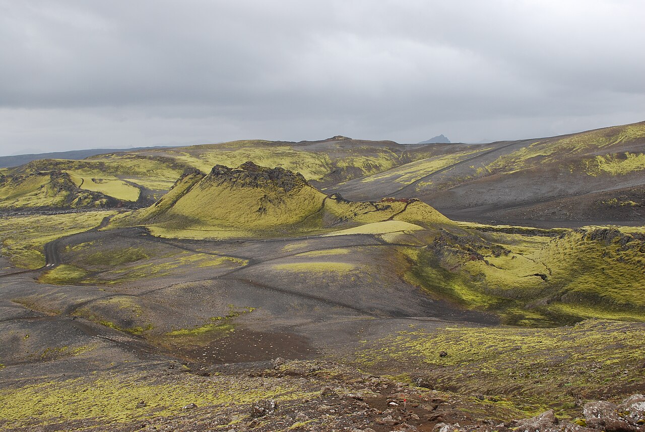
A short climb up Laki mountain for a view along the vast crater row of the 1783 eruption in the remote highlands.
- Distance
- 2.5 km
- Loop
- Time
- 1–1.5 hours
- Ascent
- 210 m
- Max 818 m
- Difficulty
- Moderate
The Laki Craters hike is a short loop up the slopes of Laki mountain in Iceland's southern highlands, looking out over Lakagígar, the line of craters left by one of the most destructive eruptions in recorded history. The loop is 2.5 km, takes 1–1.5 hours, involves about 210 m of ascent and reaches a highest point of 818 m. It is a moderate walk on a clear but steep path, and the setting is remote.
The Laki fissure erupted in 1783–84, splitting the land open along roughly 25 km and pouring out enormous lava flows and poisonous gases. The resulting famine killed a large share of Iceland's population and livestock, and the haze affected weather across Europe. Today the craters are softened by thick green moss, and from the top of Laki you can see the row stretching away in both directions. The area is part of Vatnajökull National Park.
Highlights
- The view along the crater row from the top of Laki
- Moss-covered lava from the 1783 eruption
- A remote highland setting few visitors reach
- Short walk once you have made the journey
The route
Car park to the summit of Laki
From the car park the marked path climbs the side of Laki mountain on loose volcanic gravel. The gradient is steady and short, and within half an hour or so you reach the top. Here the crater row unfolds to the south-west and north-east, with lines of cones and craters marching across the landscape.
Down and back to the start
The loop descends a different side of the mountain and returns to the car park, giving fresh angles over the lava field. Stay strictly on the path: the moss here is extremely slow to recover and footprints can last for decades. Rangers in the area can tell you about other short walks nearby.
Getting to the trailhead
Laki is reached by F206, which leaves Route 1 just west of Kirkjubæjarklaustur. The road is rough and includes four unbridged river crossings, so a proper 4x4 is required and the drive takes several hours each way. Many visitors join a summer tour from Kirkjubæjarklaustur instead. Check road.is before setting off, as F206 opens only in summer.
Where to stay
Kirkjubæjarklaustur, on Route 1, is the nearest village and has hotels, guesthouses and a campsite. There is no accommodation at the Laki car park itself, so plan for a long day trip from the lowlands.
Best time to hike
The season runs from mid-June, when F206 typically opens, to September. Opening dates vary with snow and road conditions. July and August offer the best weather and longest days. Visibility matters, as the view from the summit is the main reward.
Safety
The main risks are the access road, with river crossings that can rise after rain, and the remoteness: help is far away and phone coverage is limited. On the mountain the gravel is loose and wind can be strong at the top. Never step on the moss. Carry warm, waterproof clothes and food. Leave a travel plan at SafeTravel.is and call 112 in an emergency.
Plan & book
Book your Laki Craters (Lakagígar) hike
 Huts & stays
Mountain Huts (Ferðafélag Íslands)
Book bunks in the Laugavegur and highland huts. Summer dates sell out months ahead.
Ferðafélag Íslands (FÍ)
Guided tourHighland Super Jeep Tours
No 4x4? Modified super jeeps cross the rivers and F-roads for you, with short hikes on the way.
Licensed Icelandic operators1 day
Gear rentalHiking & Camping Gear Rental in Reykjavík
Rent tents, sleeping bags, stoves, poles and microspikes instead of flying them over.
Reykjavík outfitters
Online booking opens soon. Press any button to get notified when it does.
Laki Craters (Lakagígar) FAQ
How long is the Laki Craters hike?+
The loop up Laki mountain is 2.5 km and takes 1–1.5 hours, with about 210 m of ascent.
Do you need a 4x4 to reach Laki?+
Yes. F206 is a highland road with river crossings and requires a proper 4x4. Tours from Kirkjubæjarklaustur are a good alternative.
Is the Laki hike difficult?+
It is moderate: short, but with a steady climb on loose gravel. The bigger challenge is getting there, which takes most of a day.
Hike it with a private guide
Guided trips with a licensed Icelandic guide, including transport and huts.
Private guide requests are coming soon
We are lining up licensed local guides. Sign up and we will let you know as soon as you can request a tailored quote.
.jpg)